Advertisement

We need your help now

Support from readers like you keeps The Journal open.

You are visiting us because we have something you value. Independent, unbiased news that tells the truth. Advertising revenue goes some way to support our mission, but this year it has not been enough.

If you've seen value in our reporting, please contribute what you can, so we can continue to produce accurate and meaningful journalism. For everyone who needs it.
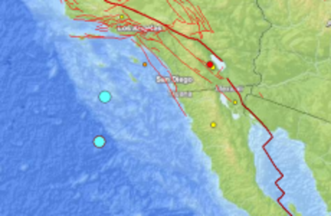
The two blue dots show the epicentres of the two earthquakes that struck off California and Mexico in the last half-hour. US Geological Survey
earthquakes

US-Mexico border hit by two offshore earthquakes

The two quakes – which struck only 17 seconds apart – are of magnitude 6.4 and 6.1, but no tsunami alerts have been issued.

THE US-MEXICO border region has been struck by two significant offshore earthquakes.

The two quakes struck at 10:36 am, and were measured just 17 seconds apart.

The quakes are of magnitude 6.4 and 6.1 respectively, and occurred about 150 kilometres apart.

The first quake was felt south of the Mexican border, about 250 kilometres off the coast, while the second struck about 150 kilometres offshore in line with the US-Mexico land border.

The US’s West Coast and Alaska Tsunami Warning Center had not issued any tsunami alerts or advisories, however.

There are no reports of any on-shore damage.

Your Voice
Readers Comments
18
    Submit a report
    Please help us understand how this comment violates our community guidelines.
    Thank you for the feedback
    Your feedback has been sent to our team for review.