Sign in. It’s quick, free and it’s up to you.
An account is an optional way to support the work we do. Find out more.
Sign in. It’s quick, free and it’s up to you.
An account is an optional way to support the work we do. Find out more.

A STATUS ORANGE rain warning has been issued for six counties over the next two days, as Storm Austen is expected to cause widespread disruption and possible flooding.
An Orange rain warning comes into effect in southern counties Cork, Kerry and Waterford at 10pm on Thursday, and will remain in place until 5am on Friday.
Separately, an Orange rain warning comes into place in Dublin, Wexford and Wicklow at 2am onn Friday, and will remain in effect until 8am.
For the rest of the country, a nationwide Status Yellow rain and wind warning will take effect at 7pm tomorrow and remain in place until 8am on Friday.
Met Éireann has warned that Storm Austen will likely cause disruption and delays to public transport services, and the forecaster said that flooding is “expected”, mainly along the impacted coastal regions.
Meteorologist Mark Bowe told The Journal that ferry routes, particularly those travelling from southern Irish ports, will “likely be affected”.
“We’ve warnings for the sea regions, so strong winds and very large waves are expected, meaning that there will be very difficult conditions for ferries to cross,” Bowe said.
An Orange marine storm warning has also been issued from Wicklow Head to Dungarvan and Valentia, as well as for the Irish Sea south of Anglesey.
Winds will reach storm force 10 at times between 9pm tomorrow and 7am on Friday.
A separate marine warning forecasts gale force eight or strong gale force nine winds around much of the coast and on the Irish Sea.
In relation to the storm making landfall, Bowe added that commuters on Friday are likely to see the impact of the storm, as there will likely be “loose debris” and possibly some blocked roads as a result of the strong winds.
Met Éireann said already saturated ground would increase the flooding risk, particularly in built-up and low-lying areas, as intense rainfall could run off quickly.
The forecaster added in a separate statement earlier that “uncertainty” over its exact track means it is not yet clear where the worst rain and winds will hit.
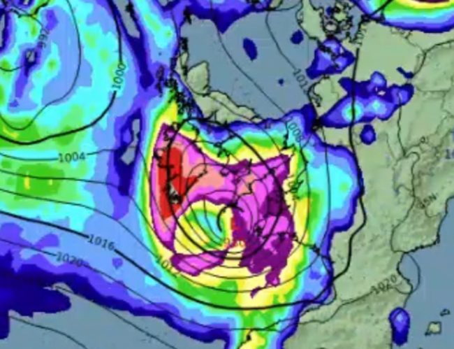
It warned that small changes in Austen’s path would affect where the heaviest rain and strongest winds occur, meaning weather warnings could be updated as confidence in its track increases.
“There is still some uncertainty in the exact track of the storm, which will affect where the heaviest rain and strongest winds will occur,” the statement said.
“Given uncertainty in the track of the storm, more significant impacts are possible and updates to warnings are likely.”
A meteorologist's commentary is now available on https://t.co/6Ifr8uXQK7 ahead of Storm Austen and a very unsettled October Bank Holiday weekend.☔️🍃 For more information, visit: 🔗https://t.co/ktXtWjbfIg https://t.co/upZ19FULLn
— Met Éireann (@MetEireann) October 20, 2026
Austen, the first named storm of the 2026/2027 season, was named by the UK Met Office.
Conditions are expected to briefly improve after the storm clears on Friday, but another area of low pressure could bring further rain and strong winds over the October Bank Holiday weekend.
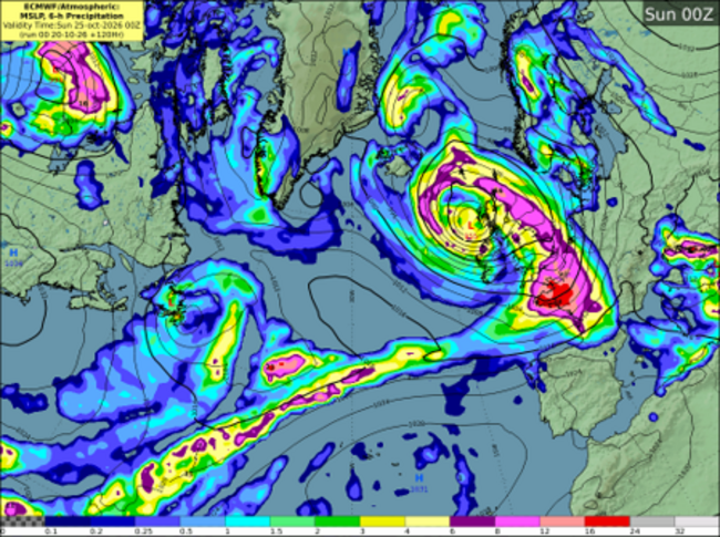
Met Éireann said there was also uncertainty over the track of that system. The combination of windy weather and spring tides could lead to coastal flooding in exposed, low-lying areas.

To embed this post, copy the code below on your site














have your say