Sign in. It’s quick, free and it’s up to you.
An account is an optional way to support the work we do. Find out more.
Sign in. It’s quick, free and it’s up to you.
An account is an optional way to support the work we do. Find out more.
LAST UPDATE | 31 Oct 2025
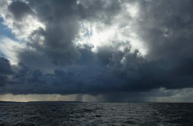
A STATUS YELLOW thunderstorm warning has been issued for counties Carlow, Cork, Kilkenny, Waterford, Wexford, and Wicklow from 7pm to 10pm tonight.
Met Éireann is forecasting heavy rain and thunder with possible spot flooding and difficult travelling conditions.
Rainy conditions are expected for most of the country tonight – but in good news for trick-or-treaters, it’s meant to be clear for the afternoon and early evening.
The national forecast for the day is fairly cloudy and wet but rain will clear in most areas by early afternoon, followed by sunny spells and isolated showers.
If you are going trick-or-treating it could be better to get out early, especially for those in counties in Munster and Leinster, as cloud will build again later this evening with rain moving up from the south.
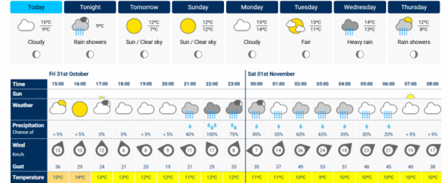
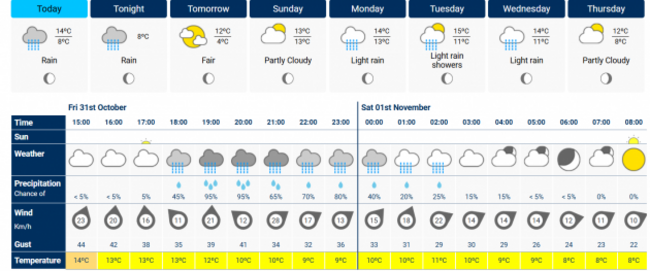
The forecast for Dublin city is dry until 9pm, with temperatures up to 12 degrees. But in Cork city it looks like it get be wet by 6pm.
Rain could also start early in Waterford city and Castlebar, Co Mayo where there could be showers by 7pm.
Finer weather can be expected in the midlands, in Athlone rain isn’t predicted until 9pm at the earliest.
Nationally, it’s expected to remain between 11 and 14 degrees for the day, and reduce to between five and eight degrees tonight.
Tonight will start cloudy with rain moving northeastwards across the country, becoming mostly confined to Ulster by early morning.
Tomorrow will start off bright and mostly dry with just some showers, mainly on the coast.
Showers will become more frequent in the afternoon and spread further east. Highest temperatures will range between nine to 12 degrees.

To embed this post, copy the code below on your site













have your say