Sign in. It’s quick, free and it’s up to you.
An account is an optional way to support the work we do. Find out more.
Sign in. It’s quick, free and it’s up to you.
An account is an optional way to support the work we do. Find out more.
LAST UPDATE | 25 Jun
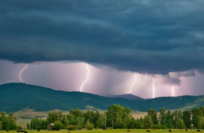
A STATUS ORANGE thunderstorm warning has elapsed but Connacht, Munster and Co Donegal are now under Status Yellow alerts.
The Status Orange alert was in place across Cork, Kerry and Waterford from 4pm until 7pm, with Met Éireann warning of the possibility of heavy downpours leading to flooding in places.
Thunderstorms are likely to develop this evening in places and come amid the heatwave conditions currently hitting the country.
Met Éireann’s radar as of 5.15pm have already shown lightning strikes in Kerry and west Cork.
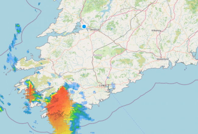
But while the Status Orange warning is over in Cork, Kerry and Waterford, these three counties now join the rest of Munster in coming under a Status Yellow alert.
The Status Yellow thunderstorm alert is in place for all of Munster until midnight.
Met Éireann is warning of possible lightning damage, hail, hazardous driving conditions, damage to utilities and very gusty winds.
Meanwhile, all of Connacht and Co Donegal is currently under a Status Yellow thunderstorm warning.
This alert came into place at 3pm and will remain in place until 9am tomorrow, Friday.
When this alert ends, Connacht and Donegal will then come under a further Status Yellow thunderstorm warning from 9am Friday until 6pm.
This additional warning will also take in Cavan, Clare, Kildare, Laois, Longford, Meath, Monaghan, Offaly, Tipperary and Westmeath.
A separate thunderstorm warning was announced for all of Northern Ireland.
The UK Met Office yellow warning will be in place from midnight until 10am on Friday.
Met Éireann has forecast that thunderstorms will develop today, overnight, and into Friday, with the risk of torrential downpours and localised flooding, as well as lightning damage, hail, hazardous driving conditions and gusty winds.
It has also warned of possible damage to power, water, gas, and telecommunication utilities.
Met Éireann has noted that for a thunderstorm to develop, there needs to be “moisture, instability and a lifting mechanism”.
“While the moisture is coming from the exceptionally warm and humid conditions we’ve observed over the last number of days, both the instability and potential lift is being derived by the weather fronts,” said Met Éireann.
“Should this trigger be enacted, it is likely that parts of the northwest and west will experience extreme thunderstorm activity today and tonight.
“Other areas may see somewhat less severe thunderstorm activity tomorrow.”
Met Éireann added that there is “some uncertainty in the model forecast on where and when exactly the thunderstorms will occur, or if they will remain offshore” tomorrow.
But should they occur on Friday, Met Éireann advised that the “intensity is expected to be quite impactful”.
Met Éireann has advised that if you hear thunder, you should move indoors immediately.
You should also avoid driving “unless necessary” if heavy rain begins.
And should lightning develop, stop outdoor sports including swimming, and seek shelter.

To embed this post, copy the code below on your site













have your say