Sign in. It’s quick, free and it’s up to you.
An account is an optional way to support the work we do. Find out more.
Sign in. It’s quick, free and it’s up to you.
An account is an optional way to support the work we do. Find out more.
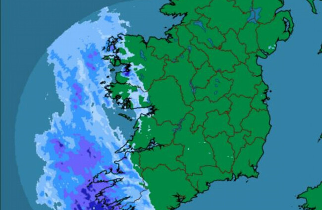
RAINFALL WARNINGS HAVE been issued for several counties, with the south of the country set to be worst affected.
Met Éireann has issued a status orange rainfall warning for Cork, Kerry and Waterford.
Rain in these counties is expected turn heavy and persistent this afternoon. About 30-40mm of rain are expected, with the potential for accumulations of around 50mm in coastal and upland areas. The rain will be accompanied by strong and gusty southerly winds.
The warning for these counties is valid from noon today until 3am tomorrow. Some localised spot flooding is expected.
Met Éireann has issued a separate status yellow rainfall warning for Carlow, Kilkenny, Wexford, Wicklow, Galway, Clare, Limerick and Tipperary.
Outbreaks of heavy rain are expected this afternoon and will persist for a time overnight. Rainfall accumulations of 30mm are possible in places, with the potential for 40mm in upland areas.
The status yellow warning will be valid from 3pm today until 3am tomorrow.
Overnight
Rain is expected to spread steadily eastwards later today. It will likely stay dry across east Leinster and central/east Ulster until the evening. It will become humid with temperatures of 16 to 19 degrees Celsius this afternoon.
Lowest overnight temperatures will range from 11 to 14 degrees in fresh or strong southerly winds.
Met Éireann says rain will become largely confined to Leinster and east Ulster tomorrow morning, with drier conditions gradually extending from the west.
Any lingering rain is expected to clear into the Irish Sea tomorrow afternoon to leave a mix of cloud and bright spells with scattered patches of light rain or drizzle. Mist and fog will persist in some coastal areas.
Tomorrow will be humid, with afternoon temperatures ranging from 17 to 22 degrees in light, variable winds.

To embed this post, copy the code below on your site














have your say